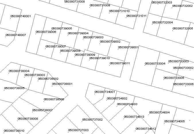
[INSPIRE] Cadastral Parcels of the Hellenic Cadastre (1:1000, 1:5000)
Cadastral land parcel boundaries maintained in the "Hellenic Cadastre" data base. The dataset refers to the land parcels that have been integrated into the "Operating Cadastre" system. They are updated periodically. The most recent updating date for each cadastral parcel is stored in its corresponding record of the beginLifespanVersion field. The minimum required scale for viewing the cadastral diagrams via WMS service is 1: 9000 or higher. On smaller scales the cadastral diagrams are not displayed for performance reasons.
Simple
- Date (Publication)
- 2019-12-16
- Identifier
- https://inspire.geospatial.cadastralparcels/001
- Access constraints
- Other restrictions
- Other constraints
- Δεν υπάρχουν περιορισμοί στην πρόσβαση του κοινού
- Use constraints
- Other restrictions
- Other constraints
-
http://www.ktimanet.gr/geoportal/INSPIRE_Terms_of_use_EN_EL.htm
- Spatial representation type
- Vector
- Denominator
- 1000
- Metadata language
- English
- Topic category
-
- Planning cadastre
))
- Unique resource identifier
- ETRS89
- Distribution format
-
-
Cadastral Parcels GML Application Schema
(
3.0
)
- Specification
-
D2.8.I.6 Data Specification on Cadastral Parcels – Technical Guidelines
-
Cadastral Parcels GML Application Schema
(
3.0
)
- Hierarchy level
- Dataset
Conformance result
Conformance result
- Statement
-
The operating cadastre system's cadastral parcels for each area were initially created as part of the land registration process for the implementation of the National Cadastre in Greece. Since then, they're being updated every time a boundary changes. The technical specifications they meet are defined by relevant ministerial or similar administrative decisions. The constant maintenance of the parcel elements is being held by the "Hellenic Cadastre" legal entity of public law, through the National Cadastre Information System. The cadastral land parcel data provided by the Hellenic Cadastre’s INSPIRE geoportal do not have a legal validity and do not, necessarily, represent the current instance of the “Operating Cadastre’s” geospatial database.
- File identifier
- GR.HellenicCadastre_FFAC7752-D8BB-43CE-B45D-B5F4F5A6C253 XML
- Metadata language
- gre
- Character set
- UTF8
- Hierarchy level
- Dataset
- Date stamp
- 2022-05-05
- Metadata standard name
-
ISO 19115
- Metadata standard version
-
2003/cor.1:2006
Overviews

Spatial extent
))
Provided by

 Κατάλογος γεωχωρικών δεδομένων